USGS · Live
Earthquakes
Magnitude and distance as soon as a quake is logged, right next to what your neighbors are reporting.
When someone nearby reports a fire or an accident, you see it on the map right away.
No install and no account to look around. The iOS and Android apps are in review.
Not in your city yet? Join the waitlist
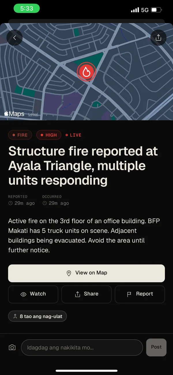
Structure fire at Ayala Triangle
Makati, Metro Manila · 8 neighbors confirming
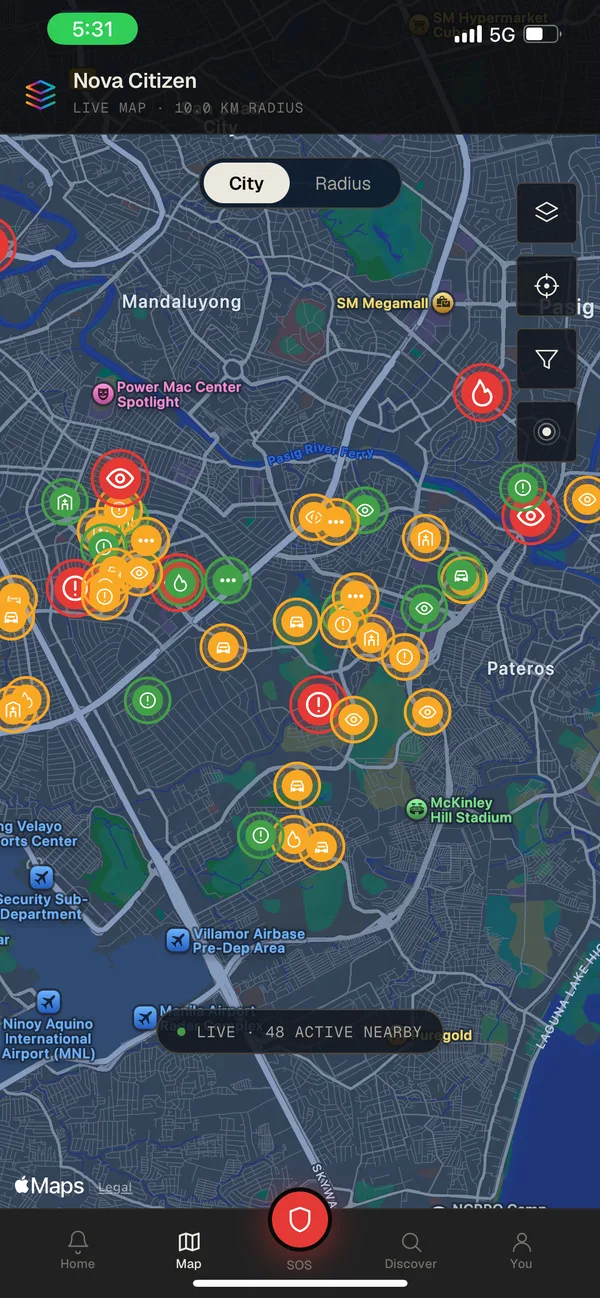
The color tells you how urgent it is. Red is happening right now, amber means be careful, green has been handled. Look at the whole city, or just the area around you, anywhere from one kilometer out to the whole country.
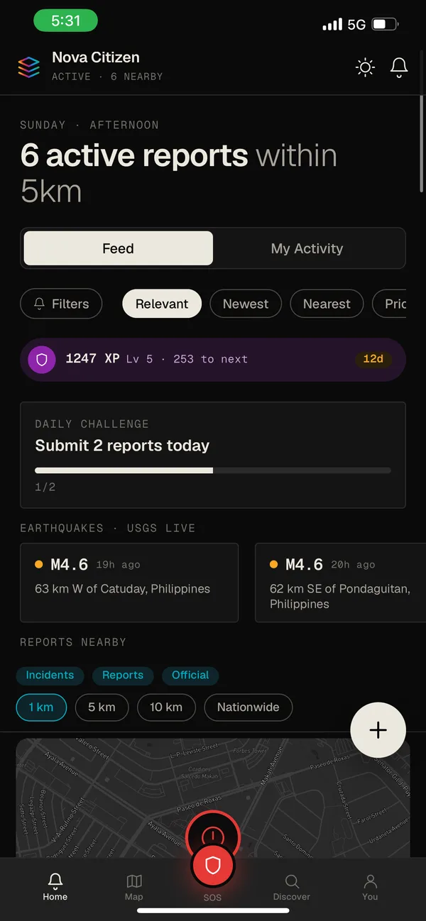
Your home screen puts what’s closest to you first, and you can switch to newest or most relevant instead. Earthquake bulletins from USGS show up in the same list as the reports your neighbors filed.
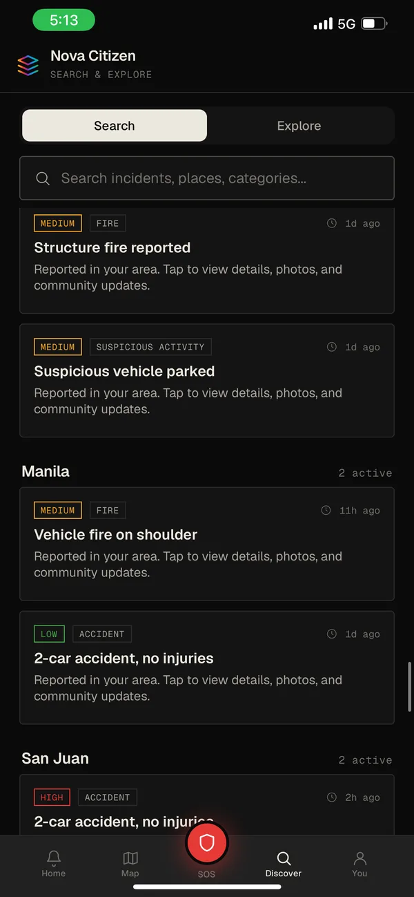
Filter by type and severity across Manila, San Juan, and Makati. Each report tells you how long ago it happened and how far away it is.
A fire, marked high severity, still going. Someone reported it a few minutes ago and eight neighbors have confirmed it. You can follow it for updates, send it to someone, or add what you can see from where you are.
Choose how far out you want to see and which kinds of reports to show. Every pin is something a person nearby actually reported.
Reports from people nearby sit next to official bulletins in one list, so you don’t have to choose between what’s quick and what’s official.
USGS · Live
Magnitude and distance as soon as a quake is logged, right next to what your neighbors are reporting.
PAGASA
Rainfall and typhoon bulletins for your area, so you know a road has flooded before you drive into it.
With pilot LGUs
Barangay and city notices will carry an Official tag, so you can show only those when you want the record. We’re rolling this out with our first pilot local governments.